Coastal Bend Storm Chasers
Storm Chasing Photo
Current Weather Condition
Current Airport Condition
Current Radar
7 Day's Forecast
>
Forecast Models
NASA Weather Satellite
Severe Weather
Today Severe Weather Outlook
Day 2 Outlook
Day 3 Outlook
Tornado Safety
Severe Thunderstorm Safety
Flood Safety Tips
Hurricane Center
Tropical Outlook Analysis
Current Tropical Systems and Maps
NASA Hurricane Satellite
Hurricane Safety
During a Hurricane
Live Traffic Map/Cam
Downtown / South Side
Central City / Corpus Christi Intl Airport
Saratoga / Yorktown Area
Corpus Christi A&M / Flour Bluff
Northwest Corpus Christi
PR 22 / ST 361 / Schlitterbahn
Brand new GOES 16 satellite are being added to this page. Some are currently operating right now.
Atlantic - Wide View
GEOS 16
GeoColor
Caribbean Sea
GeoColor
Gulf of Mexico
GeoColor
Central Atlantic
WORKING ON THIS PLATE
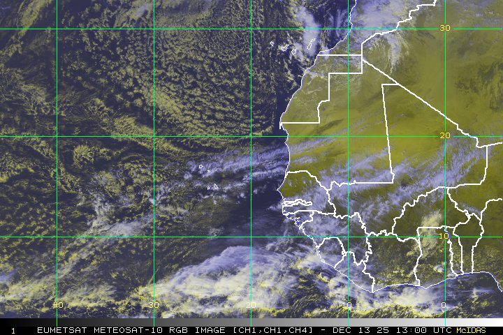
East Atlantic
WORKING ON THIS PLATE
Coastal Bend Storm Chasers
Storm Chasing Photo
Current Weather Condition
Current Airport Condition
Current Radar
7 Day's Forecast
>
Forecast Models
NASA Weather Satellite
Severe Weather
Today Severe Weather Outlook
Day 2 Outlook
Day 3 Outlook
Tornado Safety
Severe Thunderstorm Safety
Flood Safety Tips
Hurricane Center
Tropical Outlook Analysis
Current Tropical Systems and Maps
NASA Hurricane Satellite
Hurricane Safety
During a Hurricane
Live Traffic Map/Cam
Downtown / South Side
Central City / Corpus Christi Intl Airport
Saratoga / Yorktown Area
Corpus Christi A&M / Flour Bluff
Northwest Corpus Christi
PR 22 / ST 361 / Schlitterbahn